
I rode this ride last year, and enjoyed it very much. It’s been a tough year for getting brevets into the schedule for me, but this one was able to fit in just barely. Of course, that said, it sort of snuck up on me, what with preparations for the Builders’ Ball and everything else – I hadn’t even been riding that much for the entire month of September – so I wasn’t entirely what one might call “ready”. I was even hurried and haphazard with packing for the trip, just throwing stuff into bags. I arrived at my mom’s house to find that I’d brought two arm warmers that matched, and three that did not. But at the same time, I figured I’ve done enough rides where I know what I need to bring and how to load my bike, plus I’ve even done this one before. Actually, last year I encountered some navigational difficulties, so I put the ride into GPSies when I was done and had the track in my GPS this time, so I figured I could at least regain a few hours for that.
This ride has a really very scenic route, and it’s right at the height of the fall colors. It isn’t well attended, but the organizer Matt Settle doesn’t seem to mind at all doing the whole thing for only one or two people. Last year it was just me and he didn’t even mind running it for just one person. But this year I was joined by Spencer Klaassen, whom I had met a few times on other rides. Like me, he kinda got started riding brevets on a fixed gear and just kept doing them that way. He’s a strong, steady, and experienced brevet rider, and the fact that we were both riding fixed made it much easier to ride together, especially on a course like this. I think that on this route it would take a fair amount of work to ride with anyone riding gears on this ride. For those who are curious, my gear is 42×16 and Spencer’s is 42×15.
The route is absolutely relentless. In some ways I’d almost forgotten just how relentless it is – the major climbs from last year stuck out in my memory, but the rest of the ride is still actually full of climbing too. But the payoff is a mostly low-traffic ride through a very scenic state. It’s mostly an out-and-back route, except that the routes diverge for the section that goes over the big ridges between eastern West Virginia and western Regular Virginia.
My mother drove me to the start at IHOP in Gainesville, VA in the wee hours of the morning, where I met up with Spencer and Matt. It was raining at the start, but it wasn’t forecast to keep raining for too long. After a good breakfast, we were off down the road. With last year’s navigational difficulties ironed out, we arrived at the first control in Front Royal in good time, unlike last year when I was already falling behind at that point due to a wrong turn (error in the cuesheet, which has now been corrected).

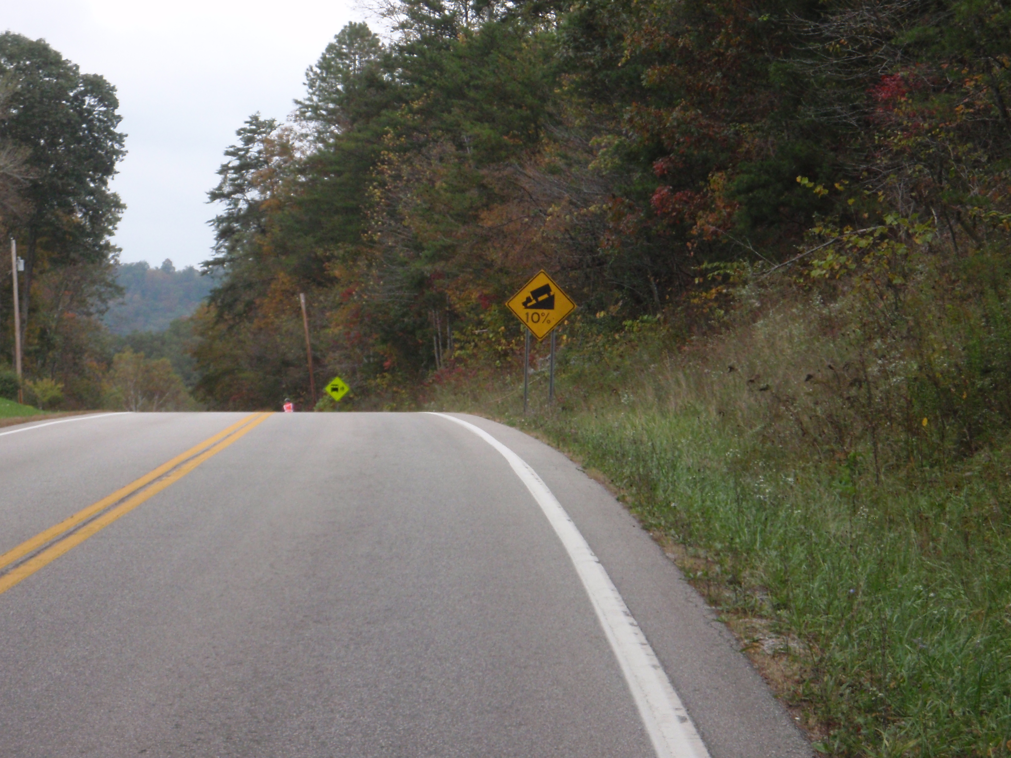
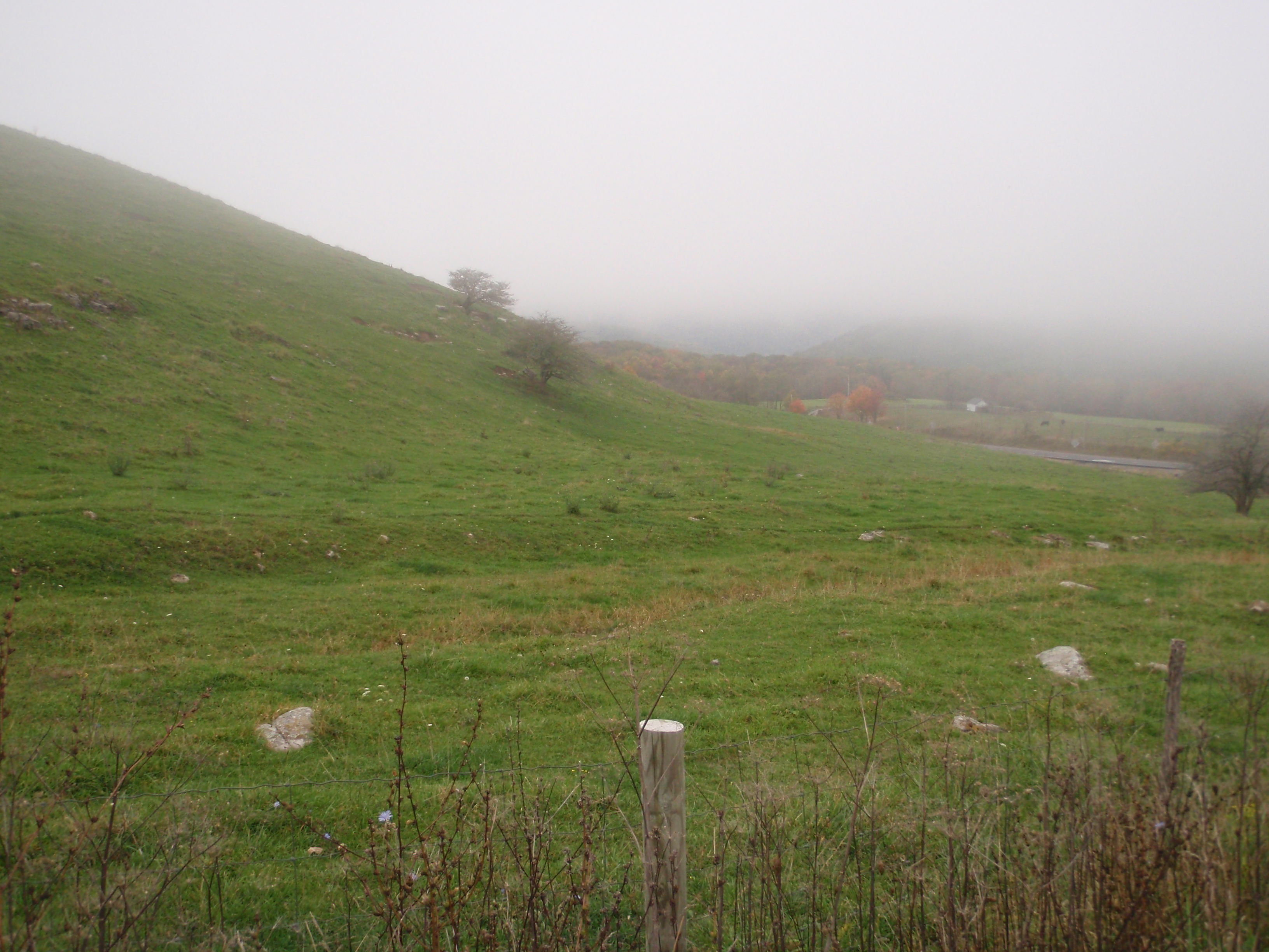
After Front Royal is where the climbing begins. There are three gaps, but they’re really just a warmup. It was still foggy and raining off and on, which was really too bad because in clear weather the views are gorgeous and this year I actually had a camera. But the roads were nice and quiet and filled with the scent of wet Autumn leaves.
Finally after descending again, we arrived at the control at the Lost River Grill an hour and a half ahead of the control closing time, with 103 mi down. We sat down and had a good square meal and some hard cider to tank up for the next climb. 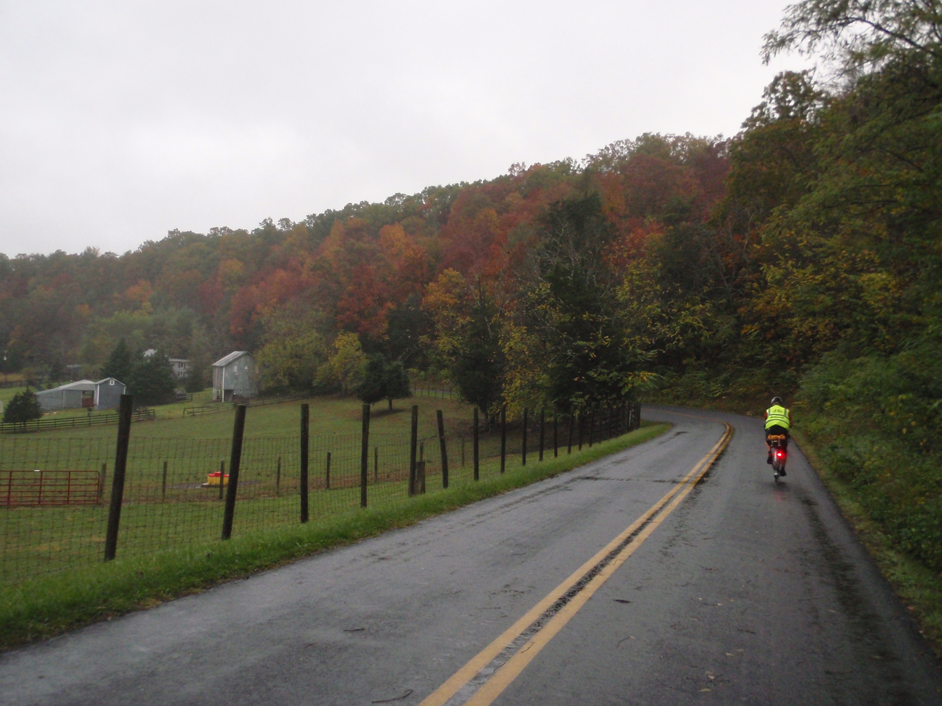
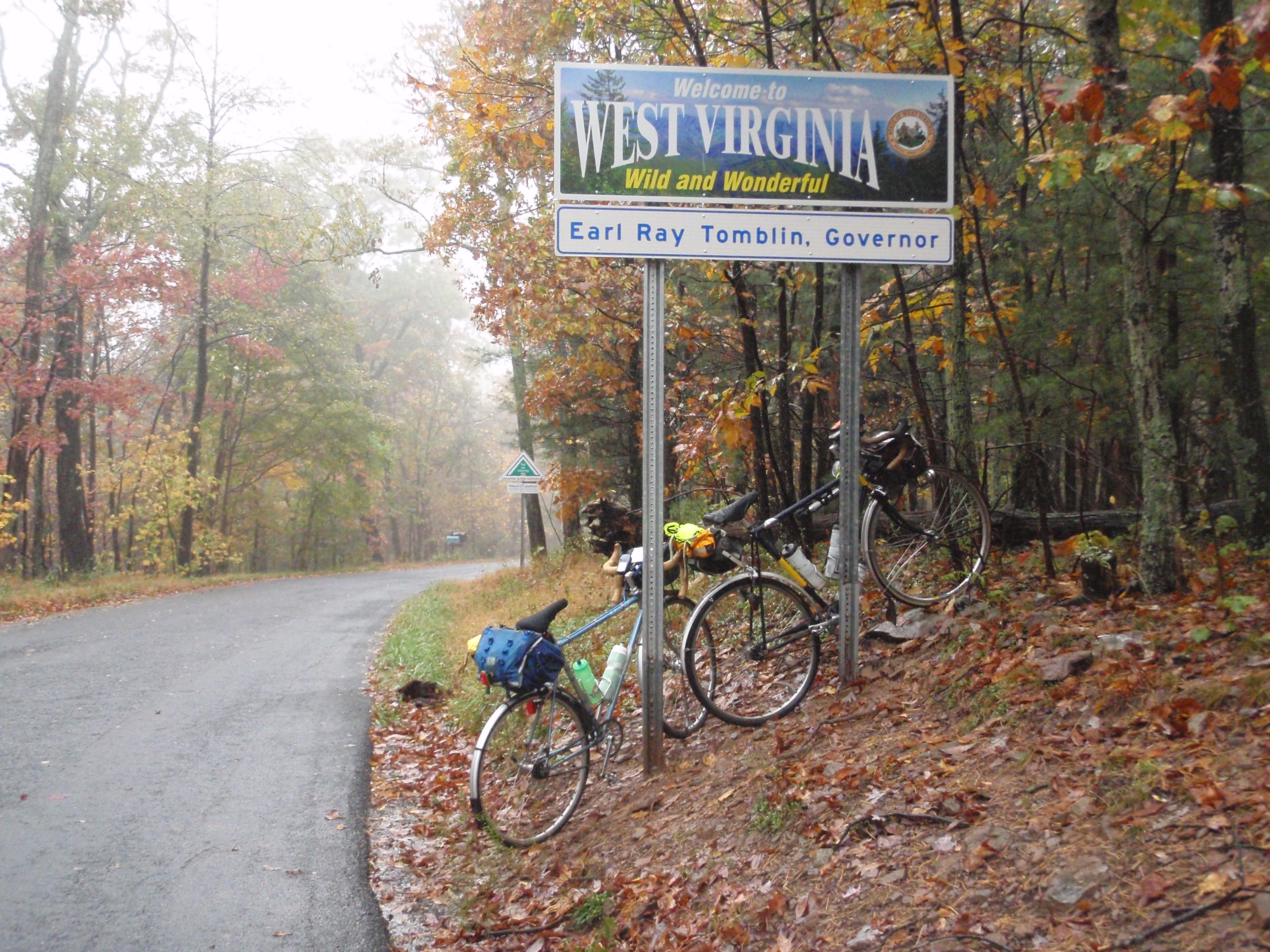
Just like last year, the climb up after Lost River State Park just does not friggin end. It goes on and on, and when you think you’re almost done with it, it goes up some more. It was raining, so the guy who told me I was almost at the top last year (I wasn’t anywhere near) wasn’t out. And there are a lot of scenic views that we couldn’t see. But we got a photo of the bikes with the state line sign.
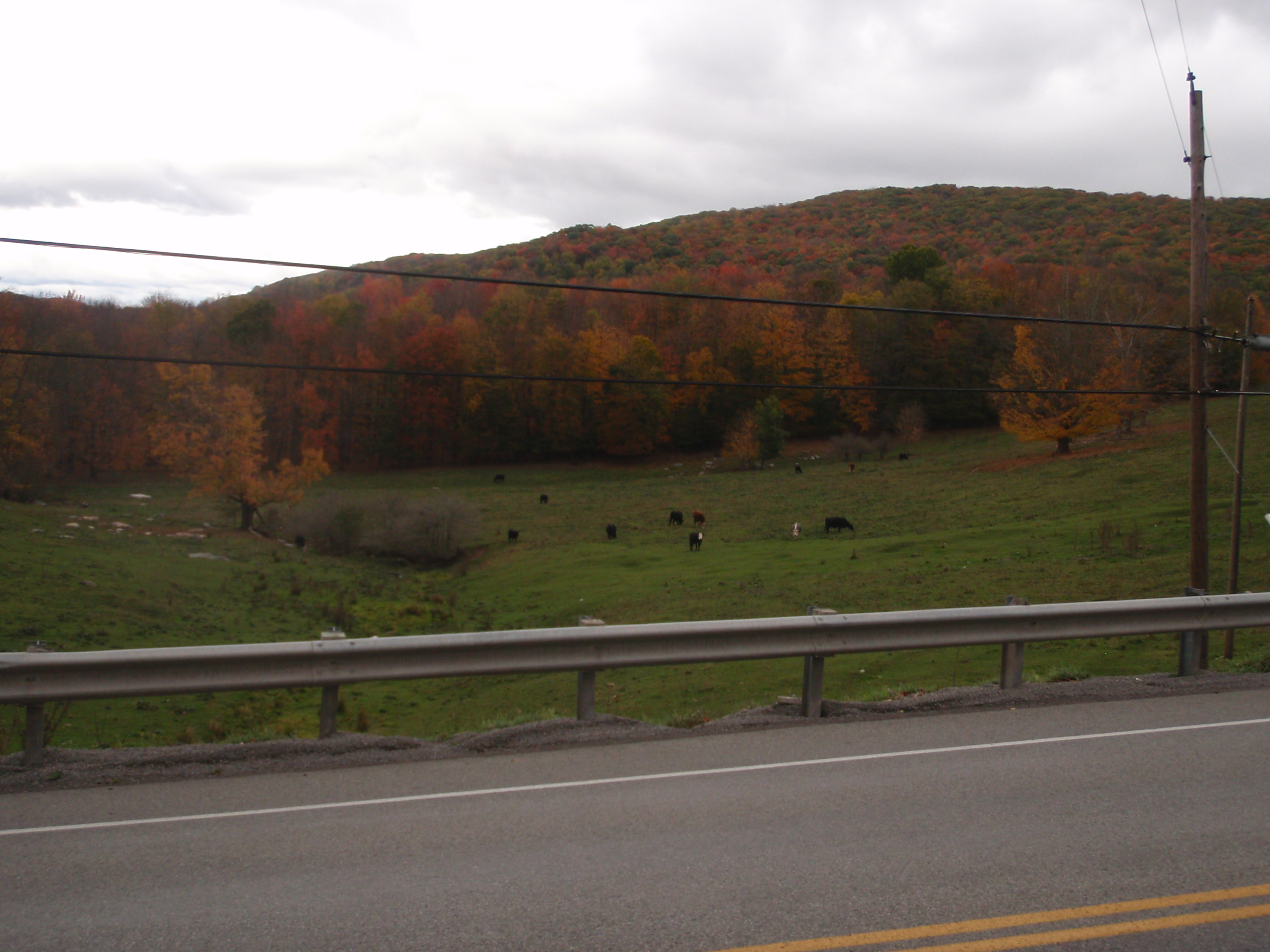
It’s under 60 mi from Lost River Grill to the store in Seneca Rocks, but it’s a long haul of 60 mi. After the big climb, there are still a few other smaller but still substantial ones. The road into Seneca Rocks is very pretty though, with open pastures and dramatic mountains all around, covered in fall colors. As you approach Seneca Rocks there are more mountains, and more sort of kitschy, touristy lodges and cabins.


Again, it’s too bad that the visibility wasn’t better, but there’s also something beautiful about the mist rising off of the mountains. My grandmother said that was the foxes cooking their oatmeal, which I find a somehow very satisfying image.
Spencer is generally a faster climber than me, although I make up some of it on the descents. However, on steeper hills he typically uses the “two foot gear” more than I do. But he walks a lot faster when pushing the bike up hills than I do. So on most hills he goes faster, but on hills with a grade that he prefers to walk and I prefer to ride, I go a bit faster. He got a ways ahead on some of the climbing after Lost River, but we arrived at the control at almost the same time.
And he has an awesome bumper sticker on his rear fender:
If you can’t read it in the photo, it says “Randonneurs go all night long, but they’ll need a receipt.” (although actually in our area, the organizers don’t usually ask for all the receipts so much except on permanents and the Fleche)
We were still doing okay time-wise, but I knew that the next chunk was especially difficult and we hadn’t built up a huge buffer, but we were still ahead of where I’d been the previous year, so I felt good about it. The route between Seneca Rocks and Buckhannon (the overnight) is probably the hardest part of the ride. Last year it was particularly hard because I didn’t really even know what was coming. There are six or so big climbs all in a row before you get to Elkins, and last year they were the biggest mental challenge of the ride. This year at least we knew they were coming, but that doesn’t make them any less work to ride up, and that stretch just takes a long time. But at least the weather was reasonably cooperative; it wasn’t raining too much, and at least it wasn’t freezing cold, like it was last year. At one point, Spencer was getting drowsy and wanted a nap in a post office we passed. I didn’t feel the need for a nap so much, but figured sitting down to eat and drink for a few minutes wasn’t a bad idea. It’s always hard to eat when you’re working hard on climbs or you’re on fast descents where you really need to be paying your full attention to the road. But it’s even harder on a fixed gear because you need both hands for leverage. I sat down and started eating a granola bar… and suddenly, after taking a big bite, chewing and swallowing that bite just seemed like the most arduous task imaginable. I closed my eyes, and next thing I knew I was waking up 15 minutes later still with my mouth full of food.
The stop did help though, and we hit the road with renewed energy. Finally we reached the gas station at the bottom in Elkins, which isn’t a control, but is a welcome stop. The clerk in the convenience store even remembered me from last year… I guess a lone cyclist out in the middle of the sub-freezing night in an area without many cyclists at all makes an impression. I didn’t really remember the terrain between there and Buckhannon (which I always think means it must be easy, since I don’t remember it being hard… but that’s actually not what it means at all!), so I figured it must be relatively flat. We decided that a beer before our sleep stop would really hit the spot, and an extra pound isn’t really that much, so we each bought a can of Blue Moon to haul all the way to Buckhannon.
The rest of the way to Buckhannon proved to be rather more of a grind than I remembered, but the beer was well worth its weight. We got into the control just a bit before closing time, which was an improvement over last year where not only did I get in late, but I was also pushing pretty hard to manage even that what with losing time over navigation. We drank our beer and got an hour and a half of sleep or so, then got back on the road.
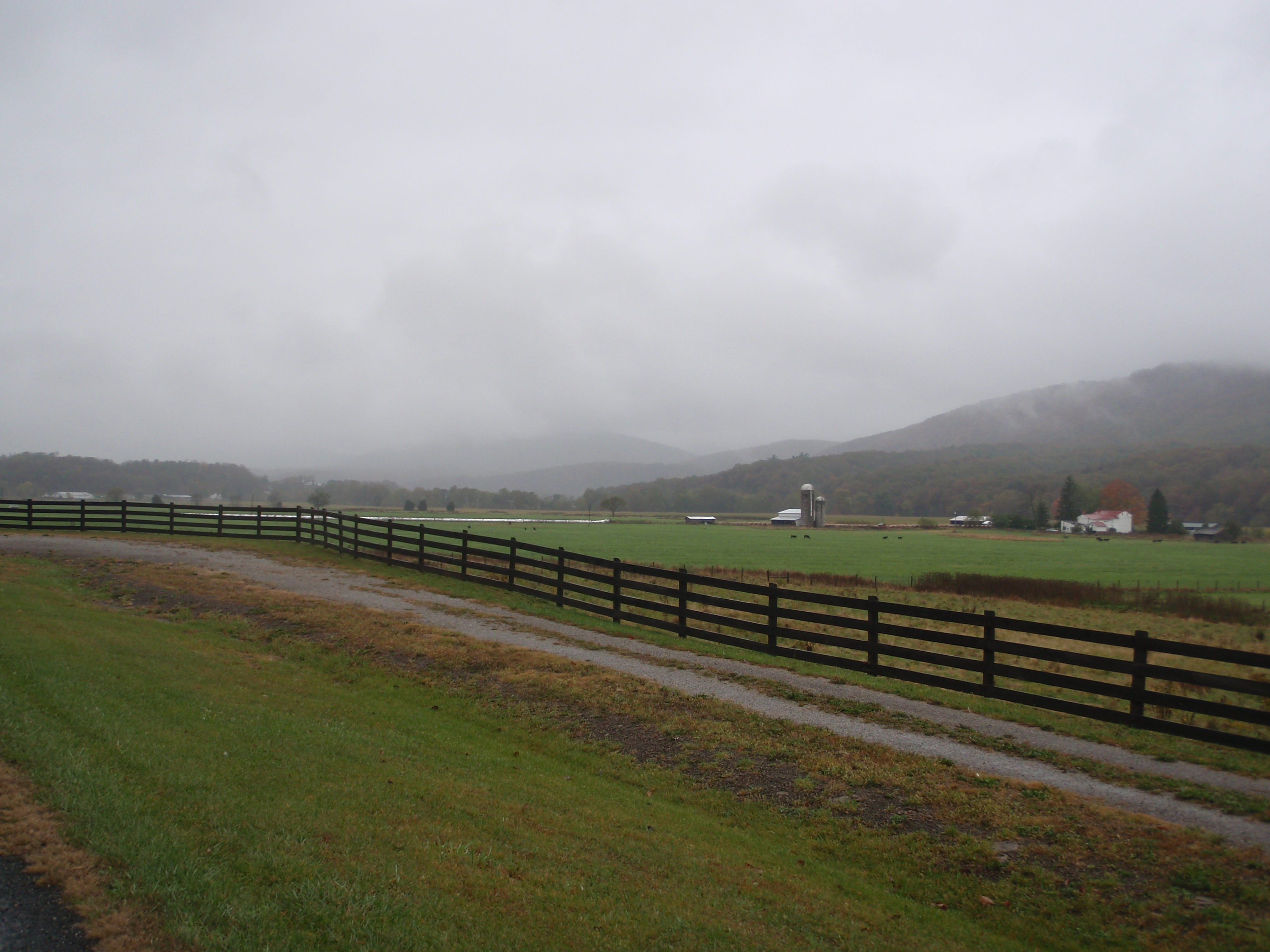
We started off the day on a wide divided highway with minimal traffic and a relatively fast downhill false flat. The morning was overcast, but the mountains around the highway were visible and the countryside was very picturesque. The highway was named after the late Senator Robert Byrd, like several other stretches of road on this ride. We made a quick breakfast stop at a Hardees. 
We stayed on US 33, but it became a much smaller road after awhile, winding through farms, trees, hills, and small unincorporated hamlets with funny names. I remembered one called Pickle Street from last year, but wasn’t able to get a photo, so I made sure to get one this year. 

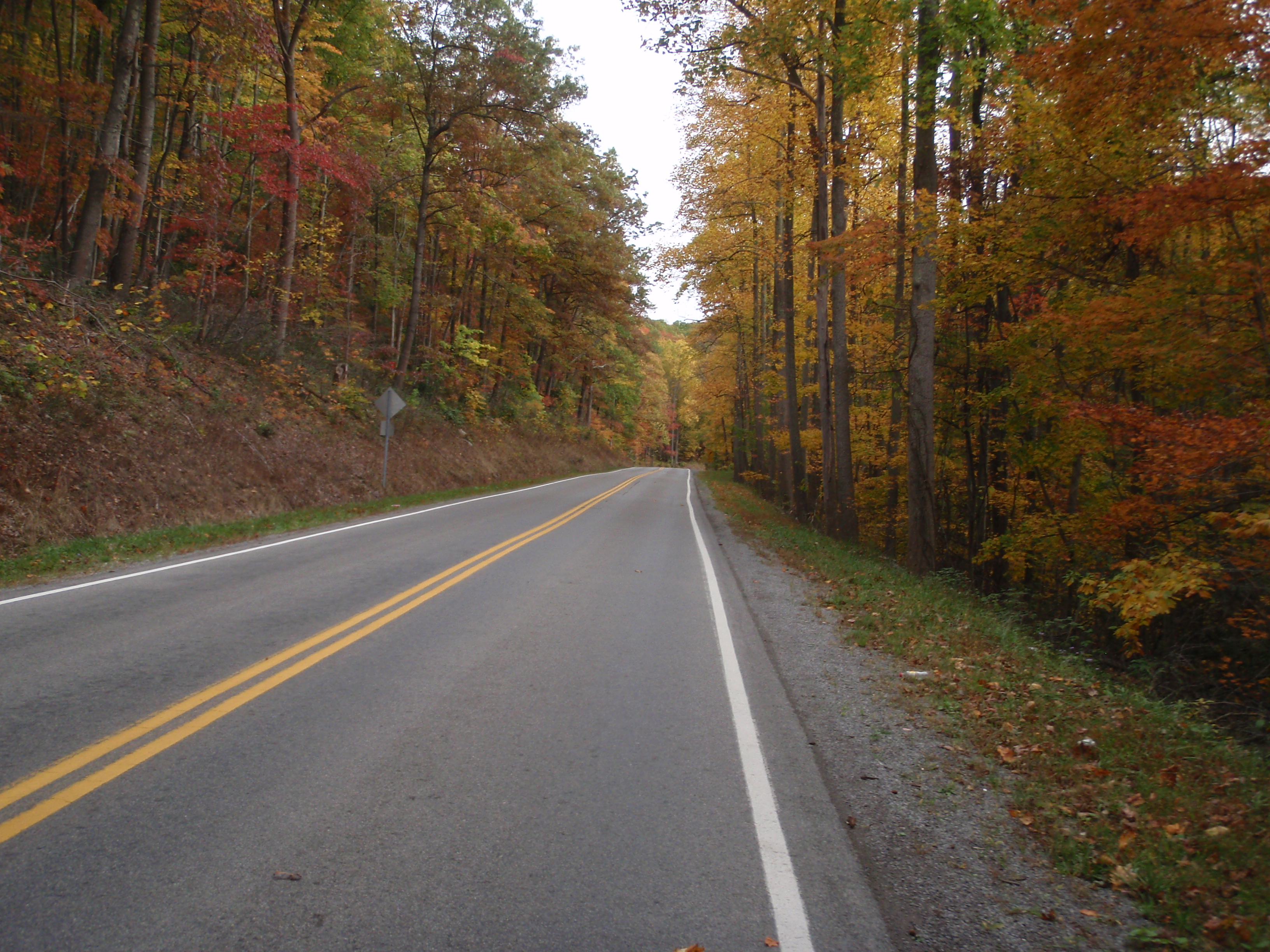
The second day is the “easier” day, in that it doesn’t have any real mountains. But it’s all relative – it still has a lot of hills that still take a long time to slog all the way up. They aren’t mountains, but some are big enough for switchbacks. They have really nice switchbacks, by the way. Nice and smooth, banked a little, and rounded enough that you can just kind of glide around them without having to lose too much speed. I like those, they are just somehow so pleasant and satisfying to roll through.

But the climbs are still relentless, and we weren’t making up much time. But we were feeling good, and the Glenville stop had a pizza/sandwich counter and a $5 special on 12-inch subs. While we were there, we were commenting on how that beer had hit the spot last night, but that we didn’t want to haul it all the way back to Buckhannon from Glenville if we wanted some more. So we called Matt from the control and asked him if he would have a chance to pick us up some during the day.
After Glenville, we were on smaller roads for awhile, with more climbs, more farms, and a few more loose dogs. It was pleasant riding and after awhile actually got a bit boring, but before long the hills started picking up again to keep things interesting. As we got closer to Parkersburg, the traffic picked up, too. The road was narrow and lots of trucks and trailers were hauling ATV’s back toward the city or toward Ohio, having presumably spent their Sunday offroading. But we finally arrived at Tim Hortons in Parkersburg, still behind the eight ball time-wise, but still ahead of where I’d been at that point on the ride last year. We had a meal and set back off for Glenville, happy to be at the halfway point.
As we were climbing away from Parkersburg, a young dog started trotting after us. It was a puppy, really; it wasn’t chasing the way loose dogs usually do, it was just sort of wagging its tail and tagging along. This was a pretty busy road, with a fair amount of fast traffic, and the puppy was just happily trotting back and forth. It followed us for awhile, and we kept thinking it would turn around and go back where it had come from, but it didn’t. It seemed like a sweet, friendly dog, actually. It would run by us, wagging its tail, then go sniff around the side of the road, then come back and say hi again. The traffic whizzed by, sometimes honking and slamming on the brakes when the puppy wandered out into the road, oblivious to the danger. I was sure we were about to watch that poor puppy become roadkill. I also wonder how many of those drivers thought we were a couple of morons who decided that letting a puppy run around with us on a busy street while we rode bikes was a good way of taking it for a walk.
We were going uphill, so there was no way we could outrun the puppy. We stopped riding a couple of times and he stopped with us, tail wagging the whole time. He had a pink collar on, but no identifying tags. Finally, Spencer thought maybe if he could distract the dog with food, we could make our exit. We thought that if it didn’t have us to tag along with, it would wander home through the yards and fields and not on the road. He opened his handlebar bag and tossed a piece of bread off to the side of the road and the dog happily ran after it, but having snarfed down the treat, came running back just as happily. Not knowing what else to do, we kept riding and soon crested the hill and started going faster again, at which point the puppy lost interest or decided to go home. I hope he made it safely.
By the time we got back to Glenville, we had made up a bit less than half an hour, and we’d been starting to get drowsy, too. I sang and recited stuff and we kept on trucking. We had been thinking that the long false flat downhill out of Buckhannon that morning was going to be a bit of a slog in the other direction, but actually it wasn’t really – if anything, it was one of the easier sections, and the prospect of beer waiting for us at the control was a great incentive. Matt was waiting for us, and true to his word, had picked up some more Blue Moon for us. It tasted even better than it had the previous night, and knocked me right out for another hour and a half in an actual bed.
In the morning (well ok, I really mean an hour and a half later) we packed up our drop bags and got ready for the final day of the ride. Matt looked up the weather forecast and said it was supposed to be warm, so we actually packed most of our warm clothes into the drop bags before leaving. With 433 mi in my legs and brain, I wasn’t thinking entirely clearly about what I packed and what I didn’t. Although I did have the presence of mind to pack the last bottle of Blue Moon into my drop bag.
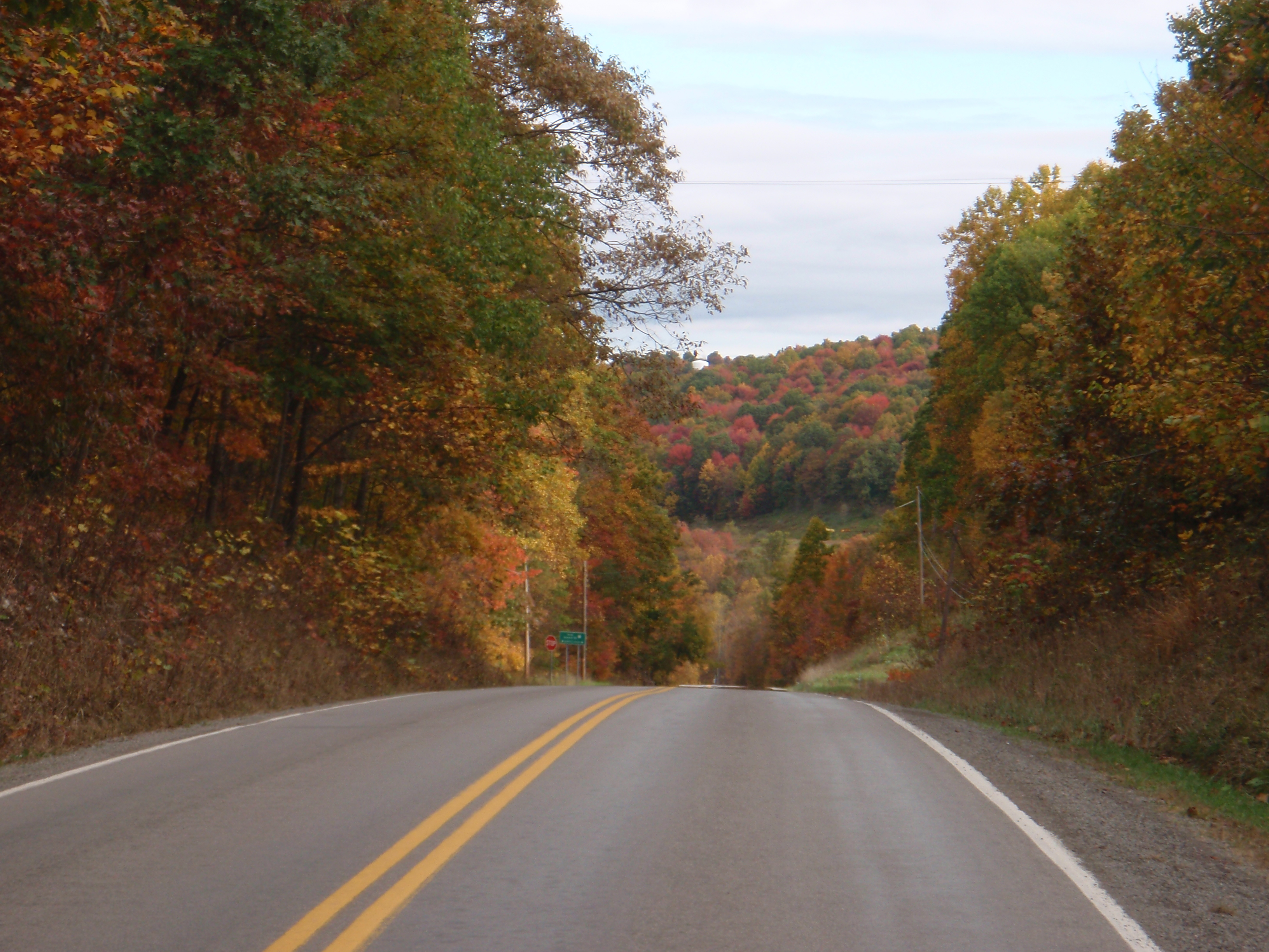
But as we headed off, the morning was mostly clear, and the sun even began to come out. By daylight, the long, grinding stretch between Buckhannon and Elkins was really, really pretty. The fall colors were spectacular in the morning light – the photos do not do them justice. If two roads diverged in a yellow wood, that’s where the yellow wood is.

Last year when I got to the control in Elkins, it was pouring down rain and about 33 degrees. I was shivering and behind schedule and stood in the corner of the store eating microwaved pasta and taping garbage bags around my legs. This year, it was warm and sunny, and I sat outside to eat my food. Spencer had gotten into town a bit ahead of me, so I was confused when he wasn’t at the gas station and they hadn’t seen him. But a couple of minutes later he turned up, having stopped at a Taco Bell where I didn’t notice his bike outside as I passed. It’s a long road over a whole bunch of passes between Elkins and Seneca Rocks and he was anxious to get going, so he pushed on while I finished eating, and then finally got back on the road.


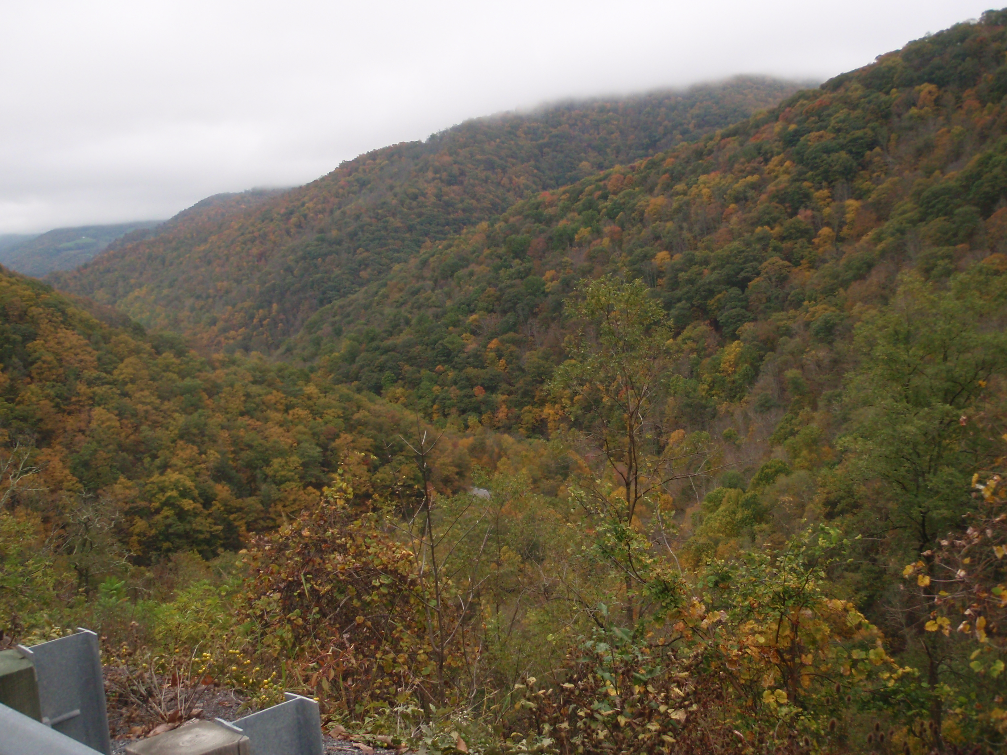
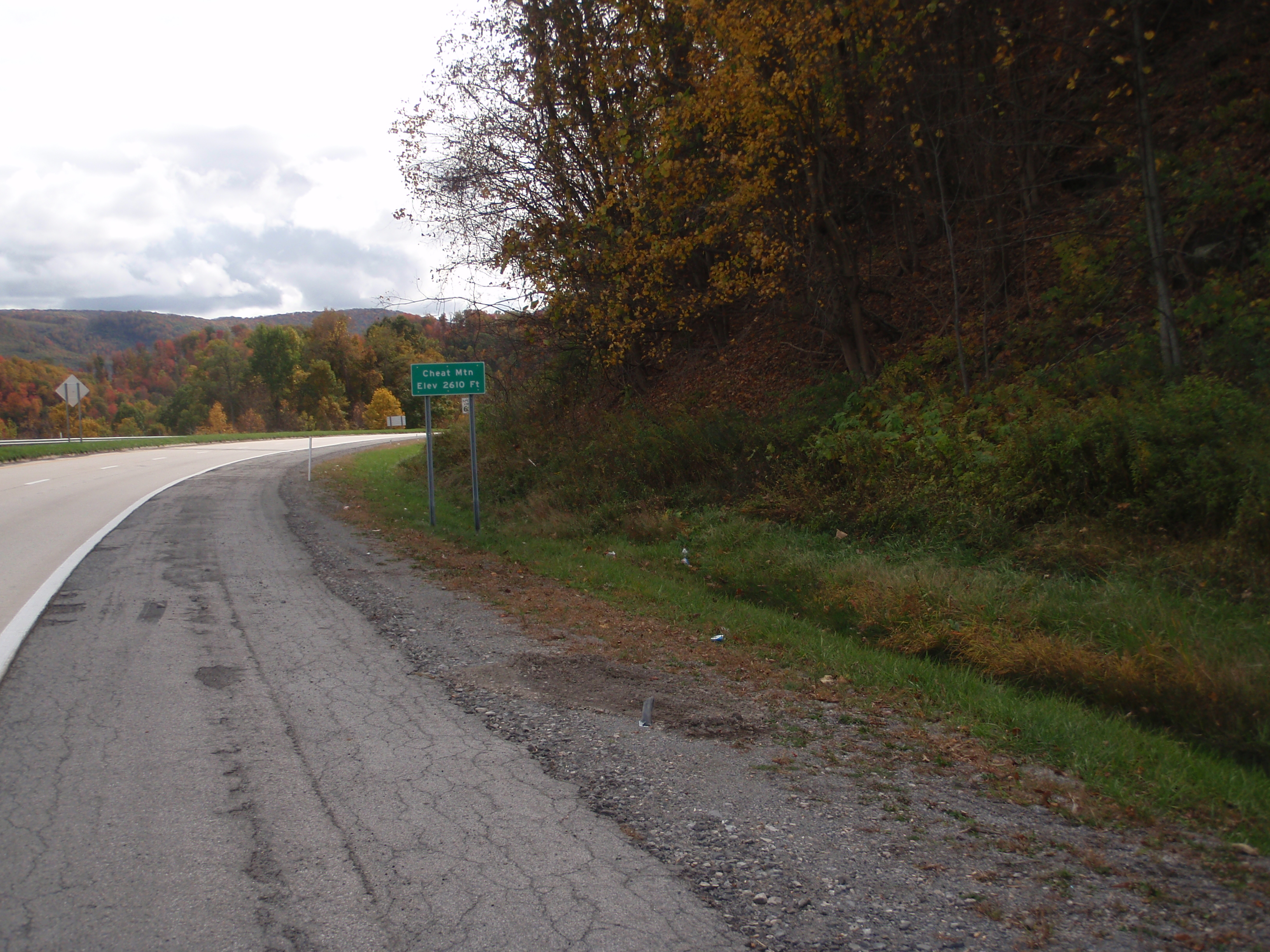
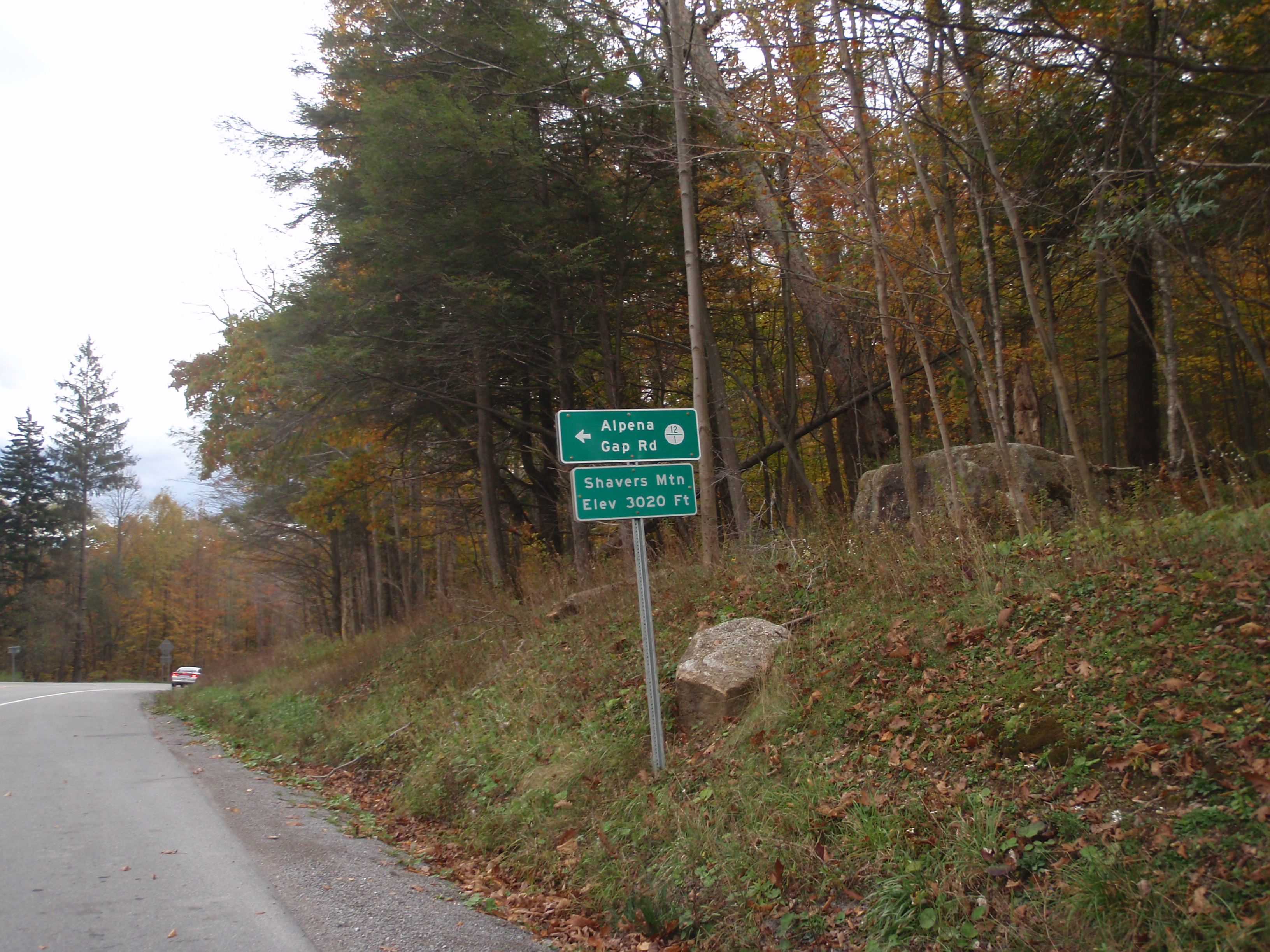
Last year, the scenery on this road was obscured by bad weather, but this year it was clear and beautiful. The mountainsides were covered in dramatic, fiery colors and the visibility was good. This is the section that has the whole row of climbs and descents, one after another. They are Cheat, Shavers, Middle, Rich, and Allegheny, plus a couple of other smaller ones without signs on top. Having now slogged my way up them twice in each direction, I took photos of each sign as I passed it. The sky was clouding over, but for the most part it was still basically clear.


I got back to Youkum’s market in Seneca Rocks still feeling pretty good. Spencer had already passed through, so I bought a bottle of milk and headed off. Sometimes it’s nice to have the motivation of trying to catch someone, plus I figured that the more rolling terrain was relatively favorable to catching up. I was making bets with myself as to whether I’d catch him before the Moorefield control, or at the control stop.

A bit before the control, I saw Spencer’s bike parked outside a DQ. I went in and got myself a quick basket of deep fried calories while he put his head down on the table for a few minutes, and then we headed off. I couldn’t remember exactly what time I’d been there the previous year, but I thought it was still later because it was dark when I got into Moorfield. But with the fast food stop, it was dark when we got to Moorefield anyway. I didn’t want to admit it, but I think we were losing time against my times from last year, which wasn’t a good sign since I’d barely made it in time in the end and had had a few navigational difficulties besides.
It was getting a bit chilly, and we were regretting having unloaded quite so much of our warmer stuff. I bought a pair of gloves at the Sheetz and a couple of Starbucks “Doubleshots”, but we kept the stop short since we’d already had our meal. Incidentally, it must be awful to work in that store. The music was blaring really loud, it was obnoxious just to be in there to buy a couple of things and leave. I can’t imagine being stuck in there all day with it every day. I know I’m more touchy about that than most, but still.

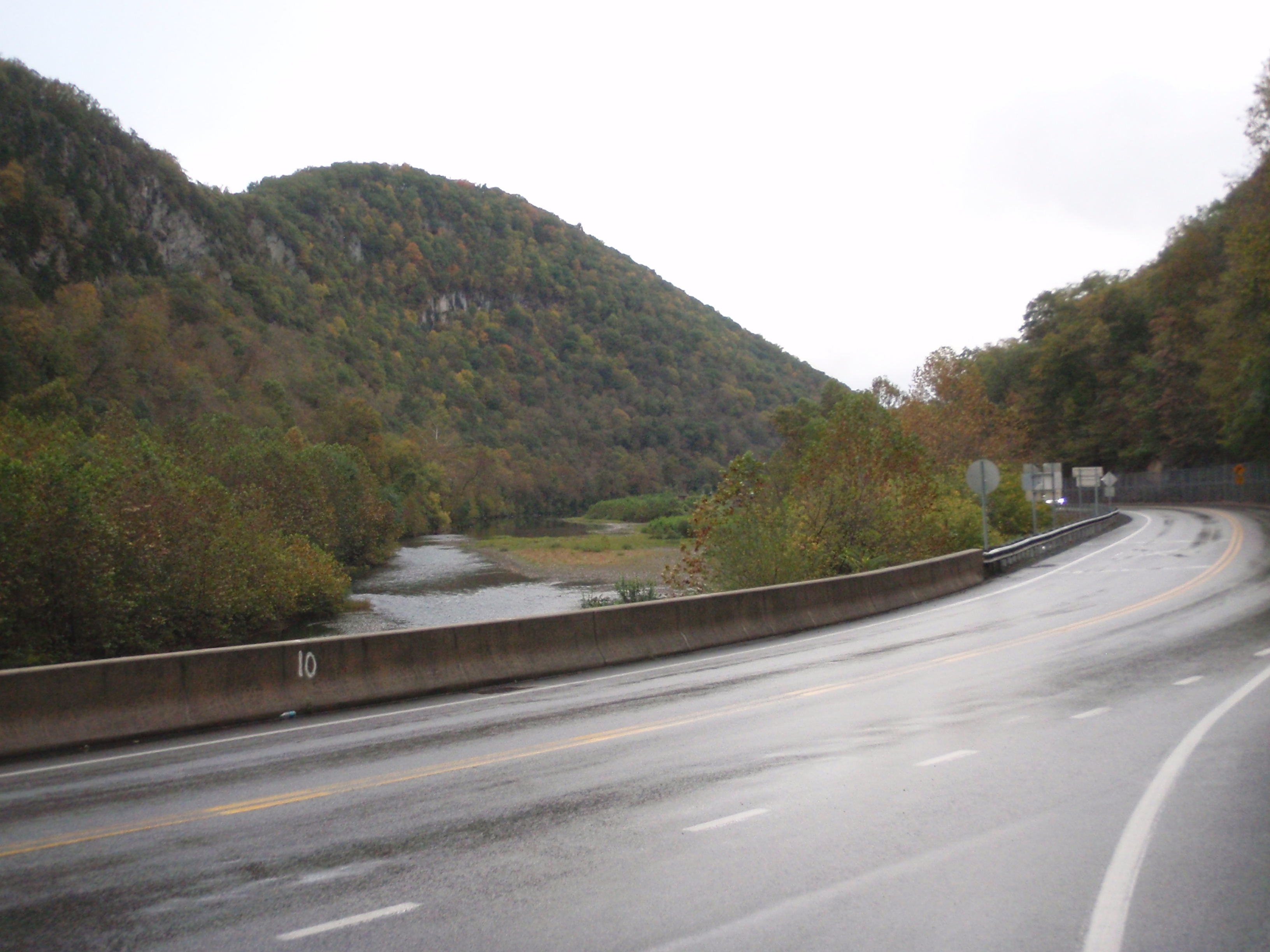
After Moorefield, the return route diverges from the outbound. You still have to get over the same bunch of big ridges through George Washington National Forest as on the way out via Lost River, but this route is a longer, steadier, more gradual incline. It goes up about 1200 ft in around 9 miles. The road is a large divided highway with a wide shoulder and only the occasional truck. Matt said that apparently it was supposed to be a major thoroughfare that would connect with a major highway in Virginia, but that Virginia never finished their side of the project. So there’s this enormous brand new highway (also dedicated to Robert Byrd) that hardly anyone uses. But it makes for not a bad bike ride, being smooth and graded and well marked and practically empty. It was a long climb, but it was an even grade that made it easy to get into a steady, comfortable rhythm even if it seemed like it would never end. There are a few more little ups and downs on the way down, and the road turns into a much smaller country road, then another ~900-foot climb, and finally the Virginia line. There were some more ups and downs, and we finally pulled blearily into the penultimate control in Middletown, VA.
I had some cup o’ noodles and Spencer had a quick nap, and we got back out on the road. It’s basically predominantly down between Middletown and Gainesville, but the first part of that leg still has a lot of ups and downs and steep rollers on country roads, and even one more 500-foot climb. I’m sure that on a Saturday morning with fresh legs, I would love that part of the ride. But at nearly 600 mi in and being down to the wire, it’s a bit like purgatory. Plus it was dark and very foggy, which made it impossible to see very far ahead. Spencer was getting discouraged too, because I kept insisting it was mostly downhill to the finish, but it sure as hell didn’t feel like it and we did not have time to spare.
Finally we got back onto the John Marshall Memorial Highway that we had started the ride on. At that point, it really is smooth, fast, and mostly downhill. So I turned up the gas and tried to take advantage, always keeping an eye on the remaining time and remaining distance. I did my best to keep the speed up on the descents while keeping Spencer in sight behind me. Finally on one of the bigger ones, he whizzed by me with his feet off the pedals. After that, we both unclipped on a few of the steeper descents to get a little more speed out, but most of the time the grade was such that at least for me it was faster to stay clipped in and just keep pedaling hard.
We spent a good hour and a half in full time trial mode. I just tried to focus on breathing and pedaling. It’s amazing how the endorphin rush makes everything else disappear – the mental fatigue, the saddle soreness, the clammy clothes, the little aches and pains that are the result of three days and nights on a bicycle. We just pedaled for all we were worth. As we got closer to the end and it flattened out a little, we went into team time trial mode, swapping very short pulls to keep the pace up. We were all set to make it with a good few minutes to spare, when we hit a red light. And then another one. And then every single other one after that. Last year I was down to the wire and finally got to the right block of shopping centers (I swear, they all look identical) and ended up riding circles in the parking lot looking for the IHOP. I was bound and determined not to do that again, and carefully watched the cuesheet…. but we still ended up riding back and forth through identical shopping center parking lots before we finally found it.
It took a hard team effort, but we made it in the end, after spending the last hour and a half or so just how I spent it last year – riding as hard as I could humanly manage for an hour and a half at the end of 75 hours. When we got to IHOP, we picked up our drop bags. I took our water bottles with me when I went to the bathroom to change, and split the last bottle of Blue Moon between the two while I was at it. I may tend toward beer snobbery in every day life, but half a warm Blue Moon in a scungy water bottle in an IHOP at 7 AM was actually beyond delicious.
Looking back, I guess I must have been generally riding faster last year, since I had a few wrong turns but finished in the same time. I was definitely pushing harder last year generally because I was so much farther behind for a lot of the ride. But last year I also felt like I needed more recovery time at many of the controls, between the freezing temperatures, the snow, and pushing the pace. This year I actually basically felt pretty good for the whole ride. Except for that last final push, I mostly felt like we were keeping a steady but comfortable pace. We didn’t rush or stress at controls, but we were for the most part reasonably quick and efficient. It’s just a very hard ride that doesn’t go fast. Matt said that in his experience, the slower folks who have done this ride (among whom I would definitely count myself!) generally seem to like it fine, because they figure on going slow in the first place and the just chug along. The faster ones don’t like it as much because, well, it slows them down too much. He said he hasn’t had anyone finish it in under 69 hours or so. It’s not the route to set a personal record! But it is a very scenic, challenging ride. In early October the fall colors are at their finest, and it isn’t hot, which some of us greatly appreciate!
So, thanks very much to Matt Settle for running the ride, and again for doing it for only two riders, meeting us in the motel, and picking up the beer. And thanks to Spencer for being good company, a steady, strong rider, and a glutton for punishment on a fixed gear. This ride was fun last year when I was alone, but it’s definitely more fun with someone else. This route is gorgeous and well worth the work, but it is not for the faint of heart. If I ever do it again, I might seriously consider using a bike with gears. And it should tell you something that it’s been a few years and a lot of long miles since I said that. But you can probably take it with a grain of salt, since I did this ride fixed last year and came back for more.


6 thoughts on “Appalachian Double Cross 1000k redux… this time with photos!”